Map of Almetyevsk
Detailed interactive map of Almetyevsk. Map of Almetyevsk with streets and numbers of houses. Satellite map of Almetyevsk with sights of the city.
The change between the satellite map of Almetyevsk and the schematic one is made in the lower left corner of the interactive map.
Almetyevsk
Population of Almetyevsk: 158,429 people (2020)
Date of foundation of Almetyevsk: 1720
Almetyevsk city phone code: +7 (8553)
Almetyevsk city car code: 16, 116
Postal code of the city of Almetyevsk: 423450-423465
Almetyevsk is a settlement in Tatarstan, which received the status of a city only in 1953, before that it was a settlement. Today, about 159 thousand people live in the city. Its leading oil industry helps the development of the city. The distance from Almetyevsk to Kazan is 249 km, to Leninogorsk - 39 km.
What to see in Almetyevsk
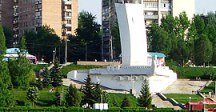
The Museum of Local Lore will acquaint the guests of Almetyevsk with its history. Although it is small, its collection of exhibits is very extensive. There are relics from the Tatar culture. Being an oil city, Almetyevsk strongly reminds of this. For example, with the help of the oil monument, which was installed in the city after 3 billion tons of extracted oil.
You can't call life in the city boring, especially in winter, since a ski resort was recently opened in Almetyevsk, calling it Tatneft. Today it is a winter recreation center.
Sights of Almetyevsk
The R.G. Galeev Cathedral Mosque, the Church of the Icon of the Kazan Mother of God, the Church of the Nativity of Christ, a cascade of ponds, a pedestrian promenade, an oil monument, a museum of local Lore, an Art Gallery, the Almetyevsk Tatar State Drama Theater.
The largest cities in Russia:
2024 © Russia-Karta.ru
