Map of Kochenevo
Detailed interactive map of Kochenevo. Map of Kochenevo with streets and numbers of houses. Satellite map of Kochenevo with sights of the city.
The change between the satellite map of Kochenevo and the schematic one is made in the lower left corner of the interactive map.
Kochenevo
Population of Kochenevo: 16,956 people
Kochenevo phone code: +7 38351
Kochenevo car code: 54, 154
Postal code of Kochenevo: 632643
Kochenevo (founded in 1650) is an urban—type settlement, the administrative center of the eponymous district of the Novosibirsk Region of the Russian Federation (Siberian District). Kochenevo is located in the south-east of the West Siberian Plain in the Ob-Irtysh interfluve (Barabinsk lowland), in the eastern part of the region, on the right bank of the Kamyshenka River (bas. Ob), 57 km west of the regional center — Novosibirsk.
Transport links: by railway (station on the West Siberian Railway, Novosibirsk–Tatarsk line); highway R-254 "Irtysh" Novosibirsk–Omsk (northern outskirts of the village) and local highways; airlines (35 km east – Tolmachevo airport in Novosibirsk).
The settlement of Kochenevo was founded on the site of the village of Kamyshinka during the construction of transport highways — the Moscow Highway and the Trans-Siberian Railway, on which the Kochenevo railway station was established in 1896. The rapid population growth occurred due to the resettlement of peasants after the Stolypin reform in 1906 and the village became a major trade and transport hub.
In 1945, the Kochenevo station annexed the village of Kamyshenka, and in 1960 the village of Kochenevo became an urban-type settlement. Today, the territory of Kochenevo is 35.94 square kilometers, where 16.7 thousand people live (2012) - the third largest settlement in the region. Economic potential: poultry farm, state farm, grain elevator, repair and technical enterprises, food industry enterprises.
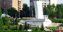
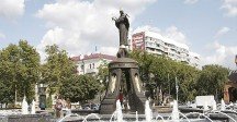
Sights of Kochenevo: the water tower (1897), the parish of Archangel Michael, Global Star (satellite tracking station).
The largest cities in Russia:
2024 © Russia-Karta.ru
