Map of Krasnokamensk
Detailed interactive map of Krasnokamensk. Map of Krasnokamensk with streets and numbers of houses. Satellite map of Krasnokamensk with sights of the city.
The change between the satellite map of Krasnokamensk and the schematic one is made in the lower left corner of the interactive map.
Krasnokamensk
Population of Krasnokamensk: 51,451 people (2021)
Date of foundation of Krasnokamensk: 1967
Krasnokamensk city phone code: +7 30245
The automobile code of the city Krasnokamensk: 75, 80
The postal code of the city Krasnokamensk: 674676, 674665, 674673
Krasnokamensk is a city in the Trans-Baikal Territory, which is the administrative center of the Krasnokamensk district and the second largest city in the Trans-Baikal Territory. This is a fairly large city in the Russian Federation, the main activity of which is based on uranium mining in the mining sector of the economy.
The economy of Krasnokamensk
Almost all the activities of the city of Krasnokamensk are focused on the extraction of raw materials, the city-forming enterprise is the Priargunsky Mining and Chemical Production Association, which is the largest supplier of natural uranium in the Russian Federation. However, agriculture is also well developed – cereals are grown here, as well as horses, sheep, pigs and cattle are bred.
The climate of Krasnokamensk is quite cold – in winter the temperature hovers around -25, in summer about +18 degrees Celsius. The city of Krasnokamensk is divided into microdistricts, which are assigned numbers. House numbers are indicated simply by a number, preceded by the number of the neighborhood number. So, for example, the house number 513 means house 13, located in the 5th microdistrict.
The history of Krasnokamensk
In 1963, the Streltsovskoye uranium deposit was opened. Immediately after that, work begins on the construction of a settlement near this deposit. Five years later, the first settlers occupied the first house in this settlement, and a year later the settlement immediately receives the status of a city. The name Krasnokamensk comes from one of the red rocks, which served as a reference point for geologists looking for various deposits.
Sights of Krasnokamensk
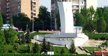
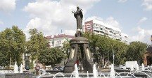
Uranium deposits, the Scientific and production uranium mining enterprise Priargunsky Combine, A Monument to the builders of the city, A Portrait of Stal Pokrovsky, A Monument to Marmots-Tarbagans, the Church of the Savior Not Made with Hands, the Shaft of Genghis Khan.
The largest cities in Russia:
2024 © Russia-Karta.ru
