Map of Perm
Detailed interactive map of Perm. Map of Perm with streets and numbers of houses. Satellite map of Perm with sights of the city.
The change between the satellite map of Perm and the schematic one is made in the lower left corner of the interactive map.
Perm
The population of Perm: 1,049,199 people (2021)
Date of foundation of Perm: May 4, 1723.
Perm city phone code: +7 342
Automobile code of the city Perm: 59, 159
Postal code of the city Perm: 614xxx
Perm Airport: Perm International Airport (Bolshoe Savino) (PEE)
Perm (formerly 1940-1957 Molotov) is a city and the administrative center of the Perm Territory. The city is located on both banks of the Kama River below its confluence with the Chusovaya. Perm is the main scientific and industrial center of the Urals.
The history of Perm
In 1723, a copper smelter was founded in the village of Egoshikha (founded in 1568), at the confluence of the Egoshikha and Kama rivers. In 1780, the settlement of Egoshikha became the city of Perm, although another city, Perm Velikaya (now Cherdyn), existed 240 km upstream from the 14th century.
Perm's position on the navigable Kama River leading to the Volga and on the Great Siberian Highway (laid in 1783) through the Ural Mountains helped the city become an important commercial and industrial center. The city of Perm is located along the Trans-Siberian Railway, which was completed to Yekaterinburg in 1878. Perm grew significantly as industrialization developed in the Urals during the Soviet period.
Economy of Perm
Modern Perm, stretching for about 50 km along the high banks of the river, is still a major railway hub and one of the main industrial centers of the Ural region. The city's diversified metallurgical and machine-building industries produce equipment and machine tools for the oil and coal industries, as well as agricultural machinery.
A large oil refinery uses oil transported by pipeline from West Siberian fields, and the city's large chemical industry produces fertilizers and dyes. Electricity is supplied from a 500,000-kilowatt hydroelectric power plant on the Kama River north of the city.
Education and culture in Perm
Among the higher educational institutions of the city is the Gorky Perm State University, founded in 1916. There are several theaters, a famous art gallery and a ballet school.
The climate of Perm
By area, it is the third city in Russia with a temperate continental climate. Due to the fact that the Kama reservoir is located near the city, the weather in Perm is characterized by high humidity and a large amount of precipitation.
First of all, Perm is known for its monuments, monuments and sculptures. Monuments to Lenin, Pushkin, Gorky, Tatishchev – all of them decorate the streets of the city. The most beautiful buildings in the city that reflect the architecture of the city are the Peter and Paul Cathedral, as well as the Gribushin mansion.
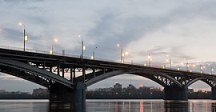
The symbol of Perm, one of the most significant structures of the city, is the Krasavinsky Bridge, which ranks third in size among other bridges in Russia. The second symbol of the city is a bear. There are several monuments to this wild animal in the city.
Sights of Perm
Death Tower, Stone Park, Paradise Garden, Gorky Park, Extreme Park, Gribushin House, Perm Cathedral Mosque, Armored Boat AK-454, Izhboldin Trading House, Tokareva Mansion, Lyubimov-Ryazantsev House, Monument to Nicholas the Wonderworker, Perm Opera and Ballet Theater named after P. I. Tchaikovsky, Rechnoy Vokzal, Diaghilev's House, Spaso-Preobrazhensky Cathedral, Museum of Soviet Naivete, Museum of the History of Motovilikhinsky Factories, Perm State Art Gallery, Museum of Local Lore, Belogorsky Monastery, Holy Trinity Stefan Monastery, Peter and Paul Cathedral, Perm Zoo, Planetarium, Balatovo Park.
The largest cities in Russia:
2024 © Russia-Karta.ru
