Map of Starominskaya
Detailed interactive map of Starominskaya. Map of Starominskaya with streets and numbers of houses. Satellite map of Starominskaya with sights of the city.
The change between the satellite map of Starominskaya and the schematic one is made in the lower left corner of the interactive map.
Starominskaya
The population of Starominskaya: 29,809 people (2010)
Date of foundation of Starominskaya: 1794
Phone code of Starominskaya: +7 86153
Car code of Starominskaya: 23, 93, 123
Postal code of Starominskaya: 353600 — 353607
Stanitsa Starominskaya is the administrative center of the eponymous district of the Krasnodar Territory of the Russian Federation (Southern District). The village of Starominskaya is located on the Kuban-Azov lowland in the northern part of the Krasnodar Territory, on the left bank of the Soska River (the right tributary of the Hey, bass.
The Sea of Azov) at its confluence with the Veselaya River on the left, 180 km north of the center of the region – Krasnodar and 120 km southwest of Rostov-on-Don.
Transport in Starominskaya
Transport links: railway junction — railway stations Starominskaya-Yeyskaya on the line Yeysk—Pavlovskaya and Starominskaya-Timashevskaya on the line Timashevsk—Bataysk; highways — highway R-268 Yeysk–Krasnodar (bypassing the southwestern outskirts) and the highway Starominskaya—Azov, Starominskaya—Leningradskaya, there is a bus station.
The history of Starominskaya
The settlement was founded in 1794, as the Men's Kuren, during the settlement of these places by the Black Sea Cossacks and later grew at the expense of immigrants from Chernihiv region. Later it is changed to the Russian way — Minsk.
In 1842, the Kuren was transformed into the village of Starominskaya, since the village of Novominskoye was also founded. At the beginning of the XX century, it was developed due to the passage of two railways, and under Soviet rule in 1924, the village became a regional center.
The economy of Starominskaya
Currently, the village of Starominskaya is the northern gate of the Kuban, its population is about 30 thousand people (2010), most of whom are employed in agricultural production. Economic potential: enterprises of the agro-industrial complex and the food industry.
Sights of Starominskaya
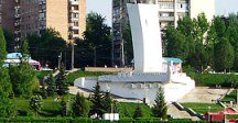
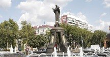
The Museum of Local Lore, the Memorial of Glory in the Park of the 30th Anniversary of Victory, the Holy Protection Church, the School of Arts, the Monument to V. I. Chapaev, a Tank from the Second World War.
The largest cities in Russia:
2024 © Russia-Karta.ru
