Map of Volgorechensk
Detailed interactive map of Volgorechensk. Map of Volgorechensk with streets and numbers of houses. Satellite map of Volgorechensk with sights of the city.
The change between the satellite map of Volgorechensk and the schematic one is made in the lower left corner of the interactive map.
Volgorechensk
Population of the city Volgorechensk: 16,653 people
Date of foundation of Volgorechensk: 1964.
The telephone code of the city Volgorechensk: +7 49453
Automobile code of the city Volgorechensk: 44
Postal code of the city Volgorechensk: 156901
Volgorechensk is the "youngest" city in the Kostroma region. It is located on the picturesque right bank of the Mother Volga. The urban-type settlement of Volgorechensk owes its appearance in 1964 to the construction of the Kostroma GRES.
Later, the settlement acquired the status of a city. Volgorechensk is young not only in terms of origin, but also in terms of the age of the residents living in it. The average age of more than 16 thousand residents of the settlement stopped at 38 years old. The city is alive and developing.
The convenient location allows citizens to get to the nearest regional centers by car in a few minutes. The distance to Kostroma is only 40 km, and to Ivanov is 60 km. River transport runs along the Volga. There are diverse enterprises operating in the modern city: - a branch of the Kostroma GRES; VolgaSFAT CJSC; Gazpromtrubinvest OJSC; a fish farm with heated water. Carp, Russian sturgeon and other fish species are grown here. The products are supplied to Kostroma, Ivanovo, Yaroslavl and Moscow.
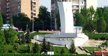
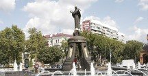
For the first time, a sculpture of a naked man was officially installed in Volgorechensk. A nineteen-meter litter was installed in Volgorechensk near the House of Culture. The patriotic song Festival has been held in the city for more than 10 years.
Sights of Volgorechensk: The Temple of St. Tikhon of Luhsky, the Kostroma Wonderworker, a sculpture of Prometheus, a howitzer Cannon from the Great Patriotic War, a fountain with illumination on the central city square, a fragment of the 19th century road "Catherine", a Chapel of worship to those who died in Afghanistan and Chechnya.
The largest cities in Russia:
2024 © Russia-Karta.ru
